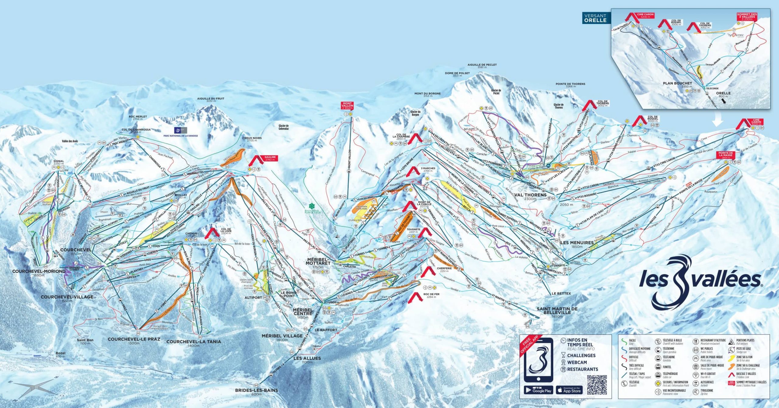
Skiing enthusiasts flock to the Three Valleys, nestled in the picturesque French Alps, for its stunning slopes and breathtaking scenery. It is a sprawling winter playground, boasting one of the world’s largest interconnected ski areas. To navigate this vast expanse of pistes and trails, skiers and snowboarders have relied on the trusty piste map 3 valleys, a visual guide that has evolved alongside the resort itself. Let’s delve into the fascinating history of the Three Valleys piste map and its significance for winter sports enthusiasts.
The concept of a piste map, or trail map, has been an integral part of skiing since the early 20th century. However, it was not until the emergence of the Three Valleys as a premier ski destination that these maps truly began to take shape. The Three Valleys, encompassing the resorts of Courchevel, Méribel, and Val Thorens, grew in popularity during the 1970s, drawing in a steady stream of skiers from around the world. With the increasing complexity of the interconnected slopes, the need for an accurate and informative piste map became evident.
The first piste map of the Three Valleys was a simple black and white illustration, highlighting the main runs and lifts. It served as a functional tool, providing skiers with a basic understanding of the area’s layout. As the popularity of the Three Valleys soared, so did the demand for a more detailed and visually appealing piste map.
In the 1980s, advancements in printing technology allowed for the creation of more intricate piste maps. Colourful illustrations replaced the basic black and white renderings, making it easier for skiers to differentiate between the various slopes and difficulty levels. The piste map 3 valleys became an essential companion for anyone exploring the vast network of trails, ensuring that they could navigate the terrain with confidence.
With each passing decade, the Three Valleys piste map continued to evolve. The advent of digital technology brought about interactive piste maps, accessible through websites and mobile applications. Skiers could now explore the slopes virtually, examining the different pistes and lifts before even strapping on their boots. These digital maps also provided real-time updates on lift statuses and weather conditions, enhancing the overall skiing experience.
Today, the Three Valleys piste map has become a work of art, combining aesthetics with functionality. Detailed illustrations showcase the intricate network of pistes, lifts, and mountain features. Skiers can easily identify the best routes, discover hidden gems, and plan their adventures with ease. The piste map 3 valleys has become an emblem of the resort, representing the world-class skiing and snowboarding opportunities available in this winter paradise.
As the Three Valleys continues to evolve and expand, so too will its piste map. Technological advancements, such as augmented reality and virtual reality, may shape the future of these maps, providing even more immersive and interactive experiences for skiers. However, one thing remains constant: the piste map will always be an indispensable tool, guiding winter sports enthusiasts through the endless wonders of the Three Valleys.
Contact us for more details of our relaxed and friendly catered chalet holidays in La Tania.


